During the front wave of the COVID-19 Pandemic in Germany, many of the cities shut down as people started to quarantine. I too was forced to work from home for a week at a time and was able to do so twice during that period before I had to return to work full time. On my weeks at home, I took the opportunity to increase my running mileage with the end goal of completing my longest run attempted to date. I am new to the ultramarathon community and have mostly run 50K-60K distances. I ran several of these distances during the spring on my own and had hoped to do a long run along the Moselle but the weather was quite unpredictable with lots of rain at times. I did not want to run in the rain all day so when I saw that the weather was going to clear one day in early June I decided it was then or never.

The logistics of running the Moselle were daunting when I first considered the project. I spent time looking at blogs or internet sites that explained how to bike the Moselle and even contract with companies who would carry your luggage from one city to the next so all you have to do is relax and bike the Moselle path. But nothing about running...

So I did what I always do, build on past experiences and figure it out. I decided to drive to a launch point in northern Trier and follow the bike path.

I started around 5 am to try to beat the heat. In the end, I wish I would have started earlier than that for the sake of the heat but I was trying to avoid running with a headlamp for as long as possible.

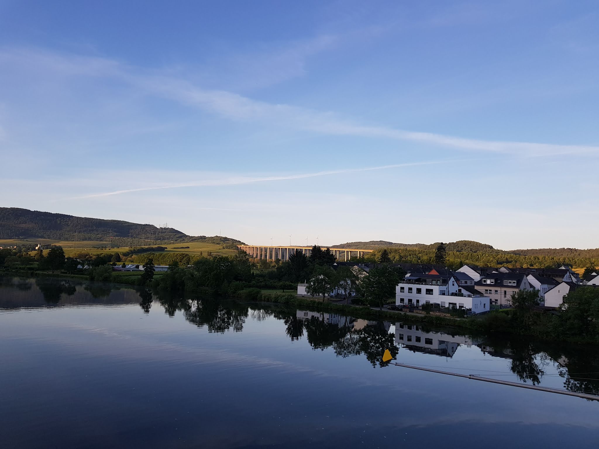
It is hard to describe the beauty of the Moselle River. It is enchanting as it calmly twists and turns through the countryside with charming cities along the way. I find the morning especially peaceful before the hustle and bustle of everyday life brings people and cyclists out.

There is a strong Catholic influence in the region, though many of the churches are no longer used. Many years ago the bishops were more powerful than many of the wealthy families and even castle owners in the region as the Arch Bishop in Trier or greater cities were responsible for assigning land and responsibility for that land to nobles. In essence, the Bishops would give the king-like status to individuals and so pleasing the Bishops was important.

Quick side note, Moselle is actually spelled Mosel but as the rare visitor to this blog will likely be mostly American, I have used the American/English spelling.

The Moselle is known for its vast amounts of grapes and varieties of wine.

Most of the grapes are used to produce white wine.

Some of these fields have been cultivated for well over 2000 years as even the Romans used this area to make and transport wine. Trier is actually the seat of the Roman government in the west and is Germany's oldest city.

The path along the Moselle is built for cyclists and in normal years attracts over a hundred thousand tourists each year. The path is mostly flat but if you want you can take small detours like this to get a nicer view of the hillside and the small towns below the path.


I had just mentioned how many of the churches are not in use anymore though many of them are still maintained. They are used on occasion for weddings or funerals.


Side note, while I was running I decided to post these pictures to Instagram and Facebook and a friend from high school replied immediately stating he know exactly where I was as he had been there! Small world and a great way to rekindle a friendship. He and I texted periodically that day.

I wondered if these regions used to receive more traffic but when the Autobahn was built (see the road in the distance) if many of them were bypassed. I don't think it has slowed the tourism for the region and honestly improves the environment of the towns.

As the sun came up it became obvious that I was going to struggle with heat that day.

I suppose you cannot expect to have everything go your way. It was either sun or rain and honestly, I would rather deal with the sun.


Mehring is one of the towns I passed through and like many of the towns has a robust Bed and Breakfast community.

And of course their local wines...


At this point, the sun was up enough that the temp increased and I pulled out my silly looking Sahara-style hat which is actually quite helpful


From here it was just hot. I decided to try to pace myself because I had a crazy distance goal (200 Km) which I had hoped to accomplish but doing intervals in the day (run/jog 1.5 miles followed by 0.5 miles of walking) and then hiking through the night. In the end, there were 2 large influencing factors for why I did not make my goal and if you want to know why I stopped you can scroll to the end.


While running along the Moselle I discovered that there is a boat/shuttle service that you can pay for and it will move you along the river like a bus. It does not run often and I am not really sure how to get passage but I found some prices posts in various towns. I think this is mostly a tourist function and given the status of COVID, I did not see the boat shuttle running.


With some of my runs in Germany, I used Garmin Connect to plan the route and then uploaded it to my watch to follow. However, it seemed like this was unnecessary based on information I found about cycling the Moselle and I found this to be correct. You simply need to keep your eye up and you find markers along the way showing you where to go as noted in the video above.


I am not sure how old some of the water tunnels are but I can tell you I was very glad they were there as I was able to reach in and dip my hat in the ice-cold water and threw it on my head. Great way to cool off.

I am not sure how old all these vineyards are but some are more recent than others I am sure. One thing is for sure, land is not wasted. I passed millions of plants that day.

Here is an example of a newer Bed and Breakfast. It was closed but had a great view.


I'm not sure of the history behind all of the small monuments along the way but they are fun to look at.

This was a cool find. I won't say much about these next pictures as I took photos of the plaques beside them. Gratefully, there were sections in English.


Another monument shows the rich religious history of the region.

Okay - time for some running logistics. I ran with a Solomon running pack that has a 2 L bladder and 2x500 mL soft flasks upfront. While this allowed me to make the distance between towns, it also added a lot of weight to my shoulders and back which actually became a problem later on.

So what I did is use google maps to search for all the names of grocery stores I was familiar with (Edeka, Aldi, Norma, Rewe, etc) and then saved them as favorites on my maps. I then used these stores as destination points along the way to buy water (cost being about 0.30 Euro per L vs 2.50 Euro per 500 mL at small bread stores along the way.

When you are not on the Autobahn there are no gas station stores to fill the need for water and food. The more you carry, the heavier it is. So this was a balancing act that I struggled with the whole day as sometimes I would have to go 10-12 miles between stores and was forced to fill my water bladder on my back with more water. Also, going to these stores would often add distance as you have to leave the path to get food and water.
This is a cheap rice pudding that was amazingly delicious.

Hot... but not at its peak yet


After making this video I was called by a coworker explaining that one of the physicians who I know from residency and wanted to volunteer in our clinic could not see patients until he had done a bunch of computer-based training which were not time-sensitive but suddenly had become time-sensitive... Not exactly the type of information that helped me stay in a good headspace.

A note about the psychology of long-distance running. I have listened to a lot of ultra-runners talk about hitting a point where they are low emotionally and physically and are able to push through it and they get a second wind. I wish I could say I know where that point is for me and that I had made it through that valley to hit a second stride but to date, I just get more and more tired and never find a second wind.
In these moments of darkness, you question your goals and it becomes easy to simply sit down and quit. Luckily, I was nowhere near mass transportation so I could not simply give up without calling someone to come get me which I did not want to do.

The first glimpse of Bernkastel, Germany! This was my first major way-point! The trick was not sitting down and giving up and calling my wife for a ride


We have been to Bernkastle a few times for the Christmas Market and to just enjoy the area. It is larger than many of the surrounding towns and has 2 sections of the town divided by the river. On the hilly side, there is a big open area (see the cars in the lower right of the picture above) where I found a bathroom.
Oh, that brings up another challenge of this run: toileting. In Europe, you need to pay for the toilet so carrying coins as weight and the logistics of finding a toilet can be very challenging, especially in the time of COVID when so much was closed.

After hitting the grocery store, and a longer break for lunch, I pushed on. I think I was at about 35 miles at this point.


One of the neat things about Germany and Europe, in general, is that so much has been preserved in terms of architecture. So while I was hot and tired, I was also enjoying the simple beauty of history.

This small section was unique in that they all had these sundials outside their homes. I did not see this anywhere else in Germany.

We had some friends that were German that built a home and actually were given money by the government to preserve the style of the old home that was on the street. I think this is the reason that so many people keep their homes appearing in the old German half-timber style.

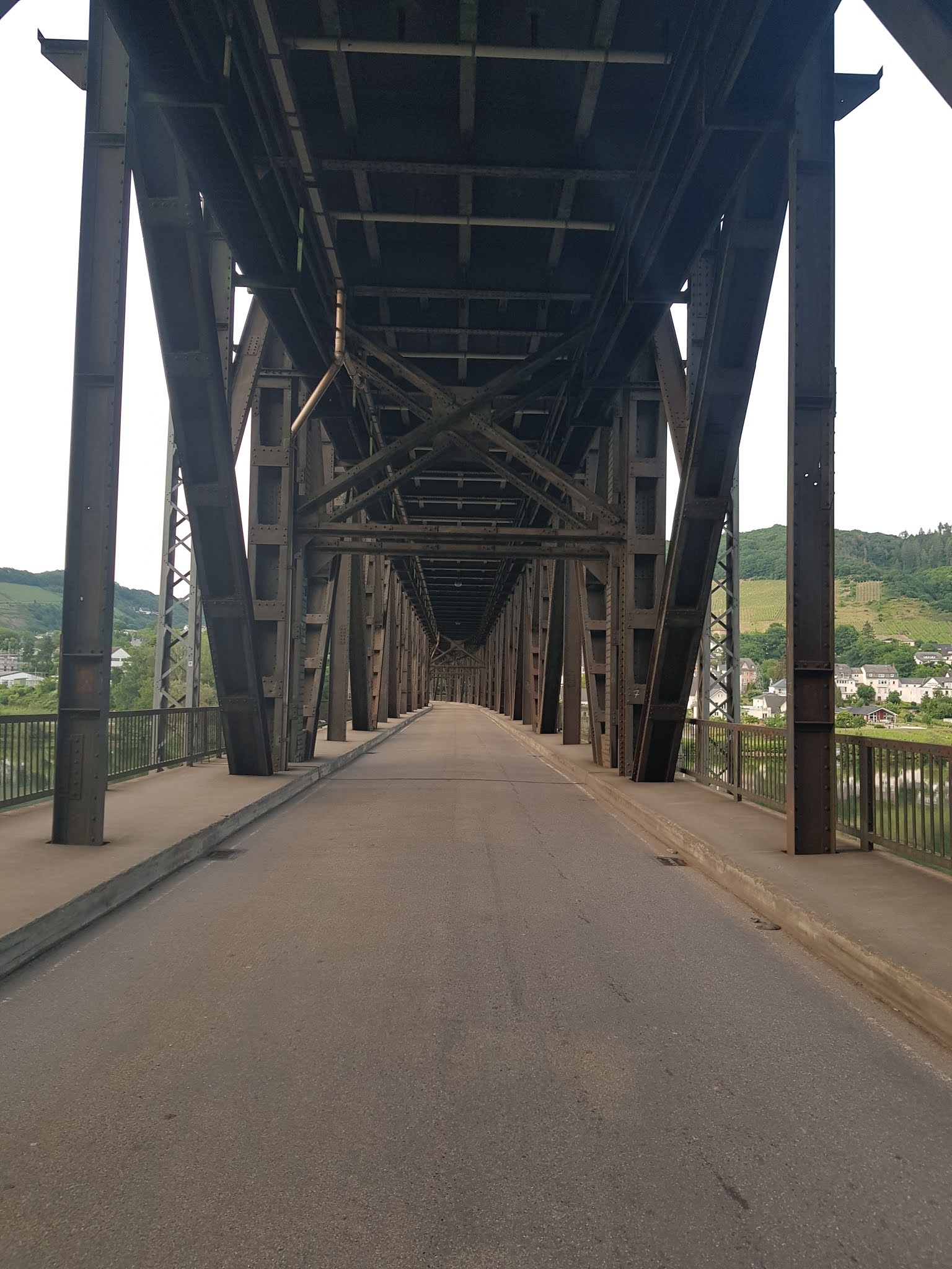
More Autobahn.

Cochem was my next major waypoint and seeing this sign almost made me cry at how far it was. I never made it to Cochem (got close, more about that later).


There were moments where I simply could not go on any longer and had to rest in the shade. I think the temp peaked at 90-93 F (my watch says 100 but I am not sure I believe that).

Here is a view of some of the machines they have invented to help with the grape harvest. I sat here while talking to Gabe Harris, the doc who was moving to Germany to take my spot in the clinic after we move.

I did not get a picture but along this busy roadway, I found some water spouts coming out of the walls below the vineyards. It was ice cold and drinkable. There were several older couples that saw me approach it and basically spray water all over me. They laughed at me (not common for Germans as they tend to silently judge you for not fitting to their normal behavior) as they could tell I was really hot. I wish there were more of these watering points along the way.

Totally random


Another video of one of the many towns I passed through.
Another village


I don't remember where this was but I think it was Traven-Trarbach.
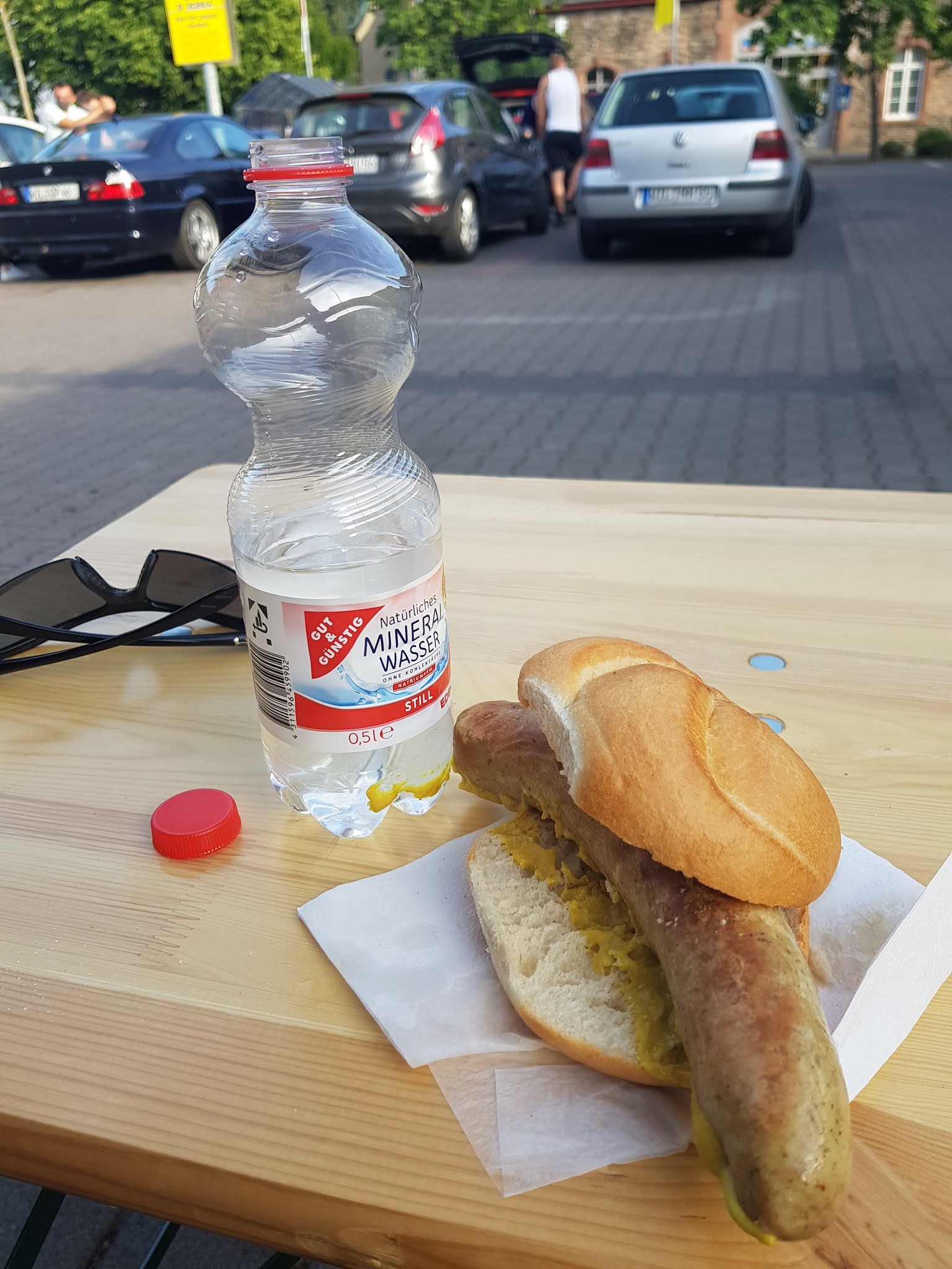
Not exactly what most runners would think of as a good meal or fuel along the way. But let's be honest, up to this point I had had gels, fruit leather bars, granola bars, fig and nut bars and the idea of the sausage was different and simply sounded so delicious. It was.

Here is where logistics became an issue. I approached the small town of Reil at 8 pm or so and realized that the next option for water was in Bullay. If I took the river path I would add on another 5-8 km and would for sure arrive after the grocery store closed. In order to make the grocery store I had to run without stopping for 6 miles and head up and over one of the hills between towns along the snake-like trajectory of the Moselle.

I did not run the stairs in case you were wondering.

While I struggled for breath I could not help but capture a few photos.


The lighting was hard to get right on my phone so while it is the same time of day some of the photos look darker than others.

After trail running down the other side, I made it to the outskirts of Bullay and was pushing to make the grocery store.


However, it became apparent I would not make closing time so from here I looked for any restaurants that might be open and found one made that my destination.


At this point, I realized that I was at 100 Km which was the longest run I had ever done. As I contemplated this, I was not sure how I could keep going without water. Yes the sun was going down, it was cooling off quickly and the night would not require as much water as during the day, but I would still need water. Option 1 was to purchase 20 Euros worth of bottled water or simply call it quits.
Also when I planned this run I knew I was going to have sun for a day and then a rainstorm was coming in. As such I had carried a massive solar-powered external battery for my phone and watch, changes of clothes, an emergency bivy bag, rain pants and jacket, and a headlamp in addition to all the other food and water I had carried throughout the day. My shoulders were not only sore but were actually bruised. The idea of hiking through the night seemed so far beyond where I was physically.

As I sat down to order a pizza I contemplated how I felt mentally and physically and my lack of water for the road ahead and decided to call it a quits. In part, even if I had access to water my shoulders were so sore that the idea of filling up a 2 L water bladder which adds an additional 4.5 pounds on my shoulders was more than I could contemplate.
Notice the salt on my compression sleeves from sweating

While it is tempting to blame how tired and hungry I was on why this pizza calzone tasted so good I will say it had nothing to do with that. It was a legit Hawaiian style pizza with amazing cheese, sauce, and crust
Gratefully Bully had a train station and I was able to catch the train back to Trier and drive home.
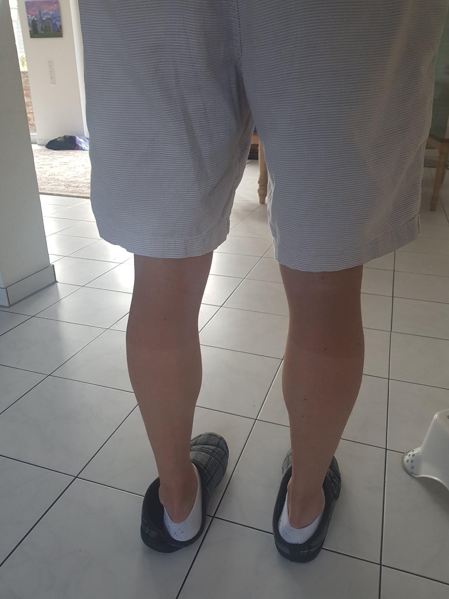
I know it is hard to see in this picture but I got sunburned on this run and you can see the tan/burn lines on my legs.
After not making my goal many people asked if I would try again. Nope. There is a trail option rather than a bike path option but I would still need to manage the water situation. A friend of mine mentioned that the cemeteries had water that you could use but were off the path and by the time I needed them, I did not want to risk getting stuck without water in the middle of the night. So maybe that can be an option for someone in the future.
Goal: 210 Km
Accomplished: 100 Km
Average Pace 14:50 (included lunches and shopping, and rest, etc)
Calories burned per Garmin watch: 6,839
Time lapsed: 15:53:10
Elevation change: 1,942 feet
Temperature range: 55-95 F
Comments